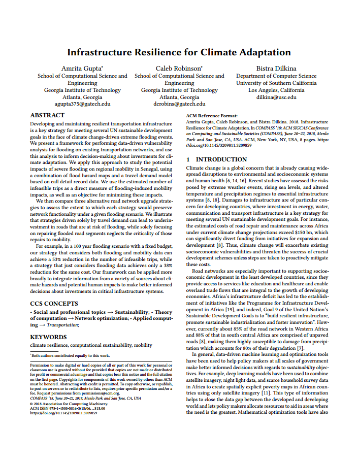
Developing and maintaining resilient infrastructure is a key strategy for meeting several UN sustainable development goals. However, global climate change will cause widespread disruption and damage to infrastructure systems, for instance due to high intensity flooding events. Our work aims to aid the development of climate resilient road infrastructure by linking together three computational modules.
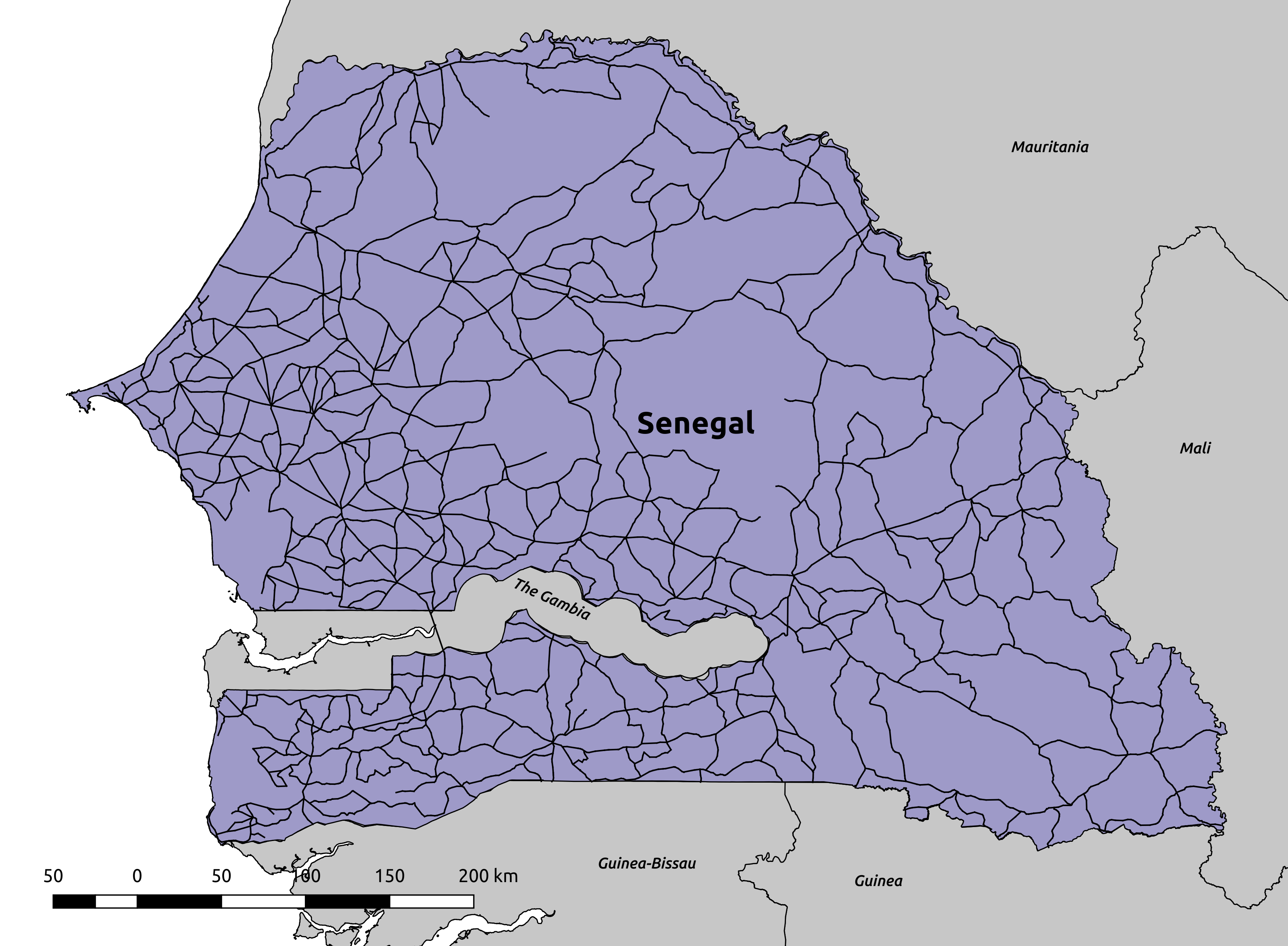
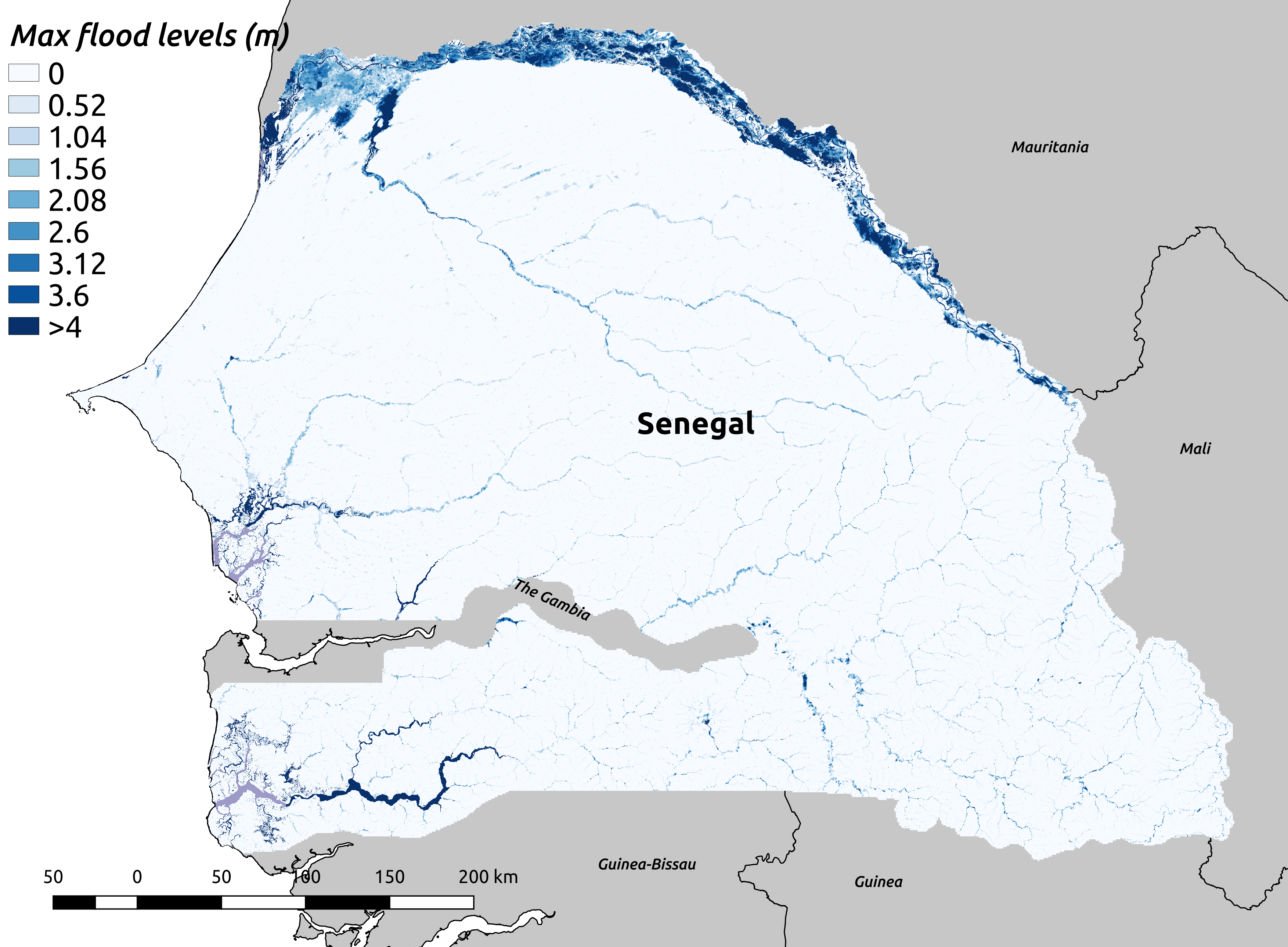
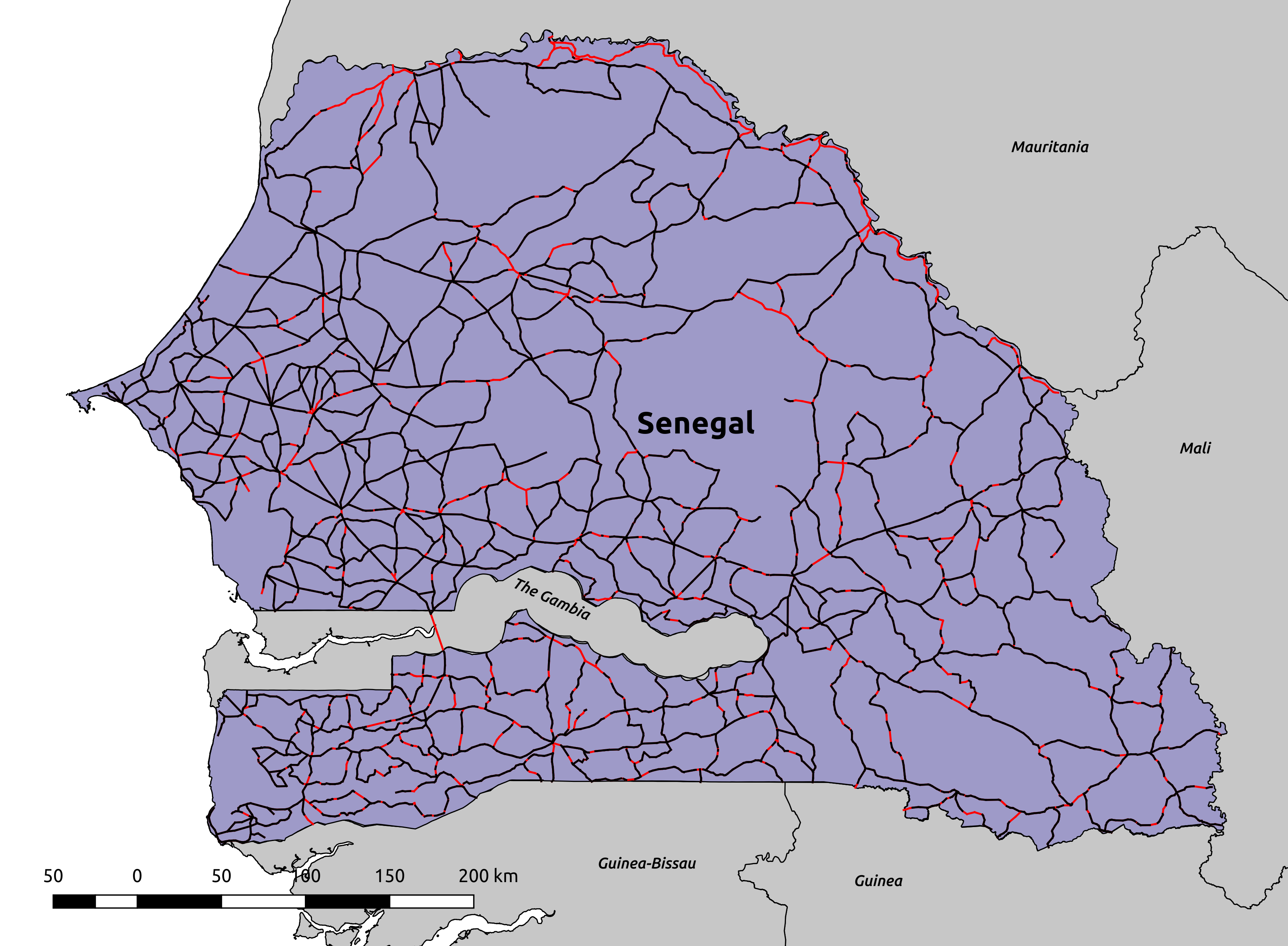
Combines a flood risk model and GIS data to determine which parts of a road network will be exposed to flooding under different scenarios.
Quantifies accessibility provided by the available road network in terms of metrics such as average trip distance and number of infeasible trips.
Prioritizes roads to fortify given a finite budget for upgrades such that the loss of mobility due to flooding is minimized.
Click on the panels below to read about some of our findings from our first paper.
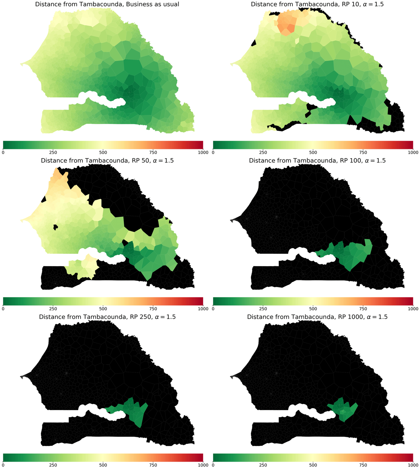
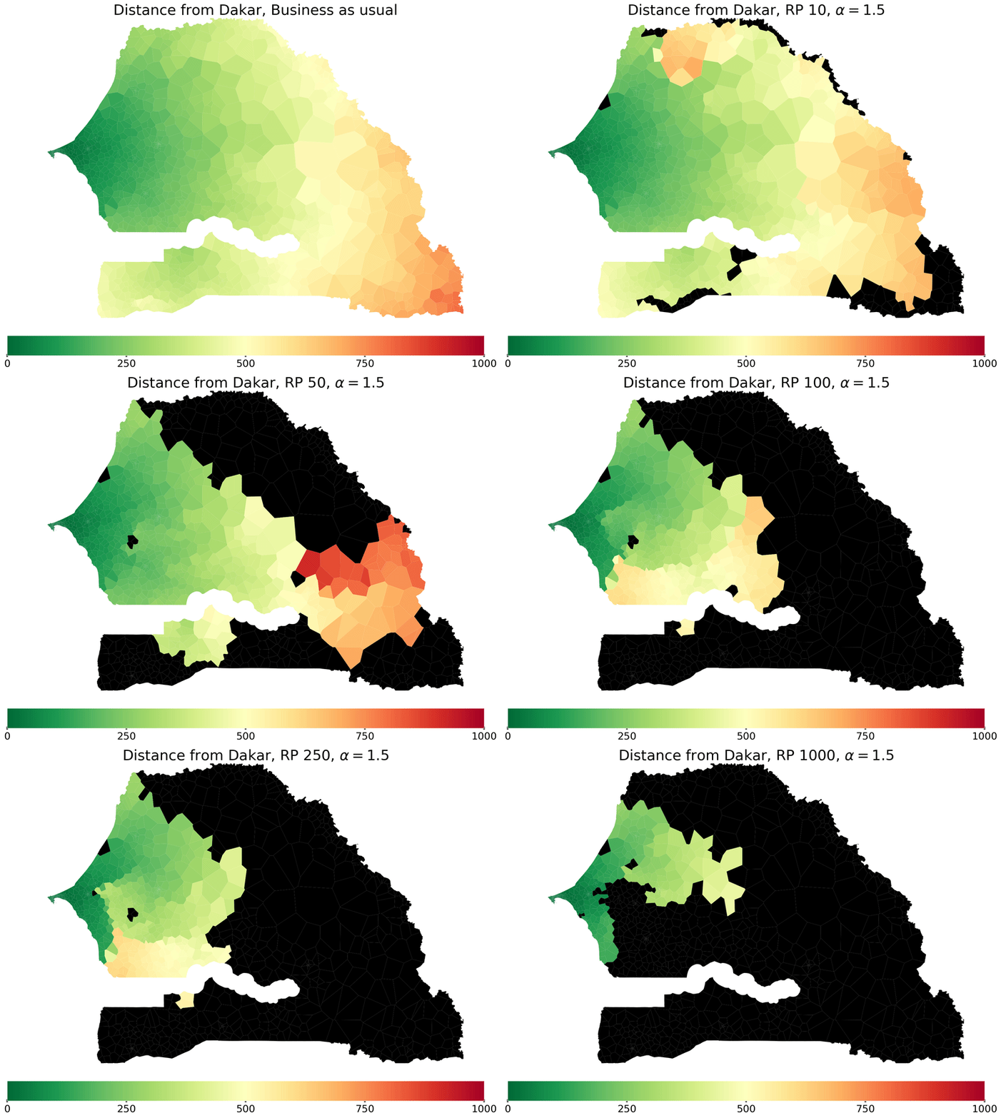
This figure illustrates how the average road network distance from Dakar and Tambacounda to other parts of Senegal increases as flooding worsens. More regions become inaccessible (represented in black) from the starting point, while the distance to regions that remain accessible increases (shown by the color bar) as the most direct paths to them become flooded. In particular, a flood of return period 75 years is enough to largely isolate the city of Tambacounda, whereas the road network around the capital would still allow access to most of western and central Senegal in this scenario.
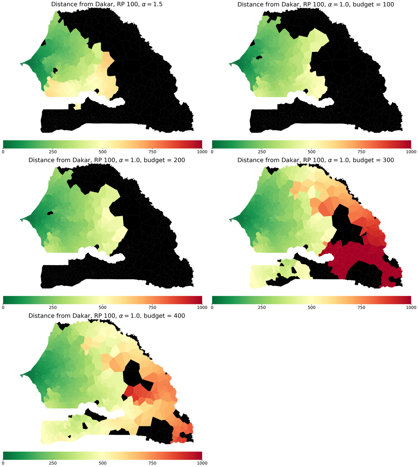
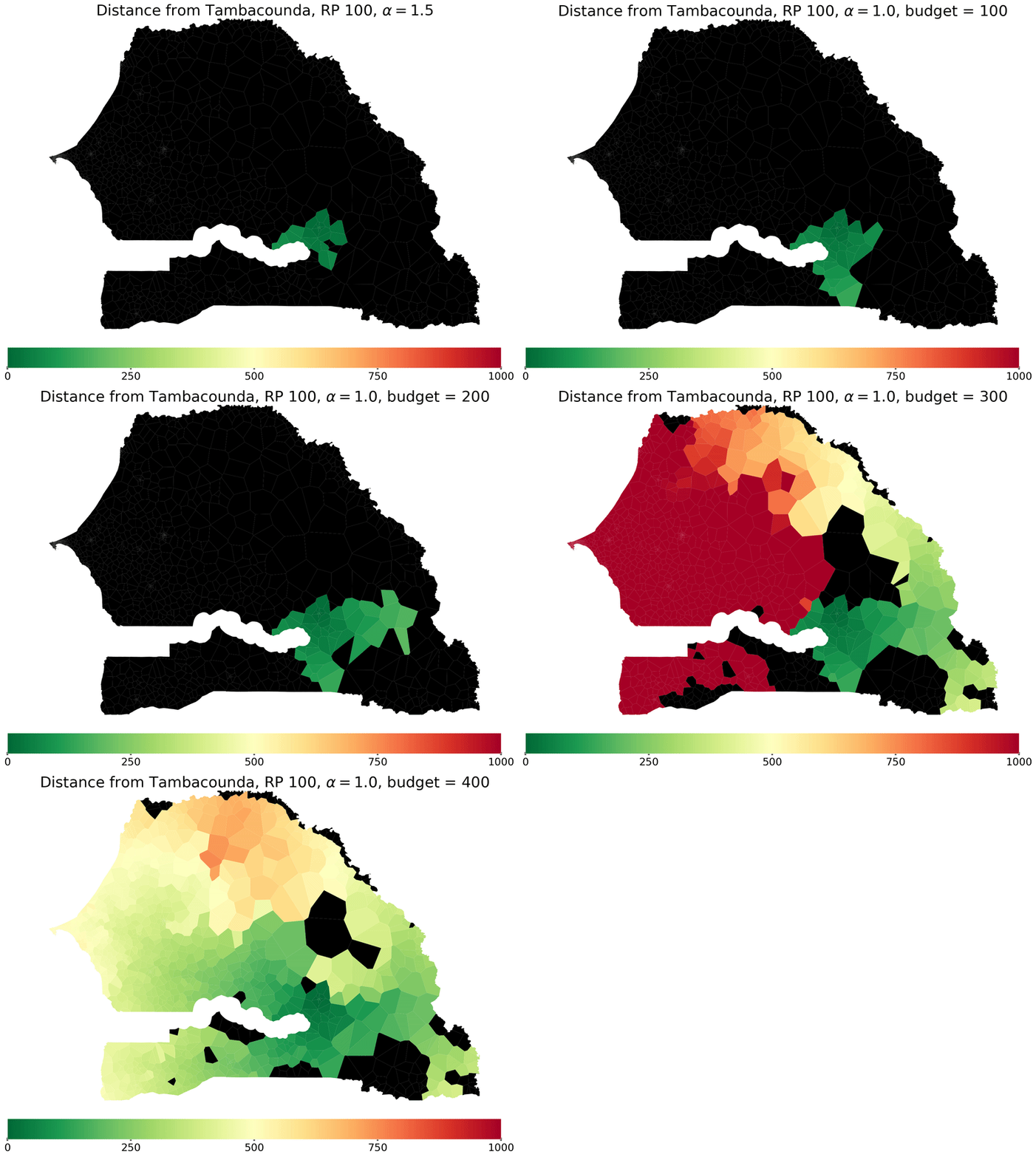
One strategy for improving road network accessibility is to upgrade subsets of roads such that the number of infeasible trips under a given flooding scenario is minimized. With any strategy, there are naturally trade-offs between accessibility improvements and the economic cost of the scheme. This figure shows how the road network distance from Dakar and Tambacounda to other regions improves as the budget available for repairs minimizing the number of infeasible trips is raised. In particular, we see a dramatic improvement in interregional accessibility when 300km of roads are upgraded.
Predicting and Alleviating Road Flooding for Climate Mitigation
Amrita Gupta, Caleb Robinson, Bistra Dilkina
8th Annual Sustainable Innovation Forum. Nov 12, 2017. Bonn, Germany.
PDF | Slides | Presentation |
Thanks to Orange and Sonatel for access to the mobility data that was used in this work.
Thanks to Fathom.Global for access to the flood data that was used in this work.